Prof. Jason P. Evans
Climate Change Research Centre
University of New South Wales


Estimating surface heat fluxes from remote sensing, process models and regional climate simulations.
Ershadi, A., McCabe, M.F. and Evans, J.P.
European Geosciences Union General Assembly, Vienna, Austria, April 3-8, 2011. Abstract
Accurate estimation of surface heat fluxes is of considerable interest to meteorological, climatological and agri-
cultural investigations as they identify the key physical processes that link the land surface with the atmosphere.
While characterising surface fluxes is critical in describing the partitioning of water and energy across Earths ter-
restrial surfaces, accurately monitoring the spatial variation, particularly at daily and sub-daily temporal scales,
is notoriously difficult. Spatial and temporal scaling issues, errors in forcing variables, heterogeneity in surface
characteristics and simplifications in process understanding, all limit the capacity to accurately monitor flux devel-
opment and variability. To examine the performance of different techniques for estimating latent heat flux requires
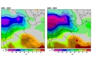
the development of a common forcing dataset. Here, output from multi-annual simulations of the Weather Research
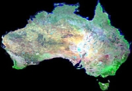
and Forecasting (WRF) model developed over Australia’s Murray Darling Basin (MDB) are used as the principal
forcing data with which to drive a number of common flux estimation approaches. In assuming consistency in
forcing data across the techniques, an assessment of the retrievals can be undertaken. Common ‘combination’ type
approaches such as the Penman-Monteith formulation are considered alongside surface energy balance retrievals
and coupled regional climate model output to examine the variation and consistency within these different estima-
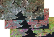
tion approaches. Remote sensing retrievals are also employed to identify issues of spatial and temporal variation.
|
|